 |
| Morning light on Pandim from camp with the 4 Chortens in the middle ground |
As the sun came up on day 7 of our trek, I reflected on what Raj had told us the day would bring: up and down for a while, then a lot of down, then a little up.
He was obviously a master of the 'quick summary' of activities.
I felt ready for just about anything. Though I was still coughing a good bit, I'd almost become used to it. I was rotating between three cloth hankies, washing them out in the afternoons and hoping they'd dry for the most part by the next morning. My stomach issues were gone, and I'd figured out how to sleep on the skinny pads. Now, if only I could get my lungs to adapt to breathing that thin mountain air, I'd be totally set!
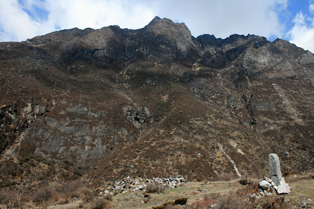
The first part of the day we retraced our steps toward the four chortens on the hill, passing them on the right at a low saddle. We followed the rolling hills of Dzongri for about an hour and a half, with spectacular views of Pandim and the Singalila Ridge to keep us entertained.
 |
| The dzo climb out of a valley in Dzongri with the Singalila Ridge Behind them. The other side of that ridge is Nepal. |
 |
| Sarah climbs to a high point with Black Kabur in the back. |
 |
| Anke and Arne near the pass before the descent into Prek Chu gorge, Pandim in the back |
About an hour into the hike, we saw our dzo guy and the animals stopped on the side of the trail near another group which had a number of ponies. A number of the animals were being unloaded. It seems that Tashi's dzo (2 of which had already been swapped out for more docile animals) were acting tired and walking too slow. He was trading them out for two of the ponies from the other group. Evidently ponies move faster and are less hassle than the larger dzo. The reduced carrying capacity generally means that the porter needs to carry more on his back, but since our group was pretty light anyway, it all worked out.
This was one thing that really impressed me about the entire trek. Everyone on the mountain seemed to work together as a team. While down in Gangtok and Yuksom they obviously competed for customer dollars, up here it was more about getting the job done and keeping everyone healthy (including the animals). Pack beasts were frequently traded, as was information about trail and camp conditions, food and even equipment such as tents, cookers and (in our case) cooks. While the foreigners were often completely oblivious of all the ways the locals were helping each other out, it was obvious that nearly all of the competition was left down the mountain. Up here, we were all on the same team.
 |
| Photo by Sarah - Ponies being loaded up |
The views kept up, too: the Prek Chu valley far below with Pandim's massive eastern face making up the far side. The entire valley had the distinctive U shaped curve of a glacially carved channel, with hanging valleys and glaciers lining the upper reaches. The sun was brilliant all morning, recharging not only my camera batteries, but my internal desert-rat batteries as well. This was turning out to be one of my favorite days on the trail!
While Tashi loaded and unloaded the animals, we continued on to a low hilltop, from where the trail began a steep descent. Even a seasoned Grand Canyon hiker had to be impressed with this particular descent - it was rocky, steep and direct. Before we could blink, we were back in the hardwood rainforests we'd left behind days ago. Between Dzongri and the crossing of the Prek Chu river at Kokchurung was a 500 meter drop (almost 1500'), and though no one could tell me the exact distance, I'd say most of the elevation was lost in about a mile and a half.
 |
| The Prek Chu gorge, with Pandim towering over. The bare looking patch in the bottom right of the photo is our destination for the day: Tanasing (or Thansing, depending on who's spelling it). |
 |
| Not a hill for those with bad knees! |
 |
| Moss on a low hanging branch, lit by the sun |
 |
| The curling bark of a rhododendron tree...every part of these plants was beautiful! |
 |
| Anke near the bottom of the hill, following a small drainage |
 |
| Crossing the Prek Chu on a small wooden bridge. It seemed woefully under-built when you looked at the size of the boulders this river moves around! |
Those of you who are hikers/trekkers will know very well the feeling you get on a very steep downhill during an out-and-back type of hike. That feeling of 'man this is nice, but I'm not going to like climbing back out this monster'. For those of you who don't hike much, you could probably compare the feeling to the one you have as you're eating a delicious, high calorie meal that you know you're going to have to spend extra time on the treadmill working off. Happiness mixed with dread, joy dulled by anticipation, elation tempered by premonition.
Needless to say, when Raj told me we wouldn't be climbing back up that particular stretch of trail I was ecstatic. No - that's too soft a word. I was positively and completely uplifted to a more transcendent plane. Suddenly my every step became lighter and my whole being nearly floated down to the base of the valley. It was the best news I'd had in ages. Our route back to Yuksom would take us along the wall of the valley to Tshoka via Phedang (where we'd be fogged in on our trip up). The pack animals, who weren't able to make the narrow trail above the river, would climb the hill but we would not. Hooray!
Of course, like all good news, it really sounded better in that moment than it would days later when I was walking through a misty shroud on the icy slopes of that detour. But I get ahead of myself...
 |
| Anke and Chung-Wan contemplate the mighty Prek Chu |
 |
| The first mile or so of the trail from Kokchurong to Tanasing was along the riverbed itself, and was very rocky |
 |
| Clearly this riverbed has drained more than a few glaciers in its time - the huge boulders are well polished by more than just the flow of water. |
 |
| As the day wore on the mists began to come and go |
 |
| High tech signage ;) |
 |
| This was a common scene, but one which I found it difficult to photograph diplomatically. I can't say why I found it so fascinating that the pack animals were carrying food and shelter for the humans, while the humans are carrying food and browse for the pack animals... |
The trail eventually climbed up a bit above the riverbed and back into the more sparsely vegetated slopes. We continued to have excellent views up and down the river, and our climb continued to be steady toward the flat expanse of the meadows at Tanasing.
 |
| Snow on the northern side of the higher peaks from which we'd just come. |
 |
| Construction on a new trekker's hut at Tanasing. The older one, which was said to be similar to those found in Dzongri, was destroyed by the earthquake. |
 |
| Camp at Tanasing, and the mists are closing in - Photo by Sarah |
We weren't at Tanasing long when the mists began to close in once again. There was a caretaker's cottage here, and it seemed like perhaps more comfort amenities for the trek crews. Perhaps this is why the boys decided to hold an impromptu game of cricket. Nothing like running, batting and throwing a round rock while you're at 13,000'.
The Americans, Frenchmen and Germans watched from a distance and Alok - who was the only one of us familiar with the game and it's rules - explained to us the way the game is played. Kind of, anyhow. He lost patience with our stupid questions (as he should have) and eventually went out an joined the game. It didn't seem as though there were winners or losers in this particular sporting event - but everyone clearly had a very good time. I got out of breath just watching them!
The game was eventually called in order for the cook to get back to his kitchen to prepare us yet another elaborate dinner. After all, we'd only eaten like 3 times already that day!
Day's hike: 8km and 270 meters lost (about 5mi, 864feet)
 |
| Extreme high altitude cricket |
 |
| Pizza for dinner - with peas, cabbage, tomatoes, cheese and a sauce which was strongly flavored with clove. Not my favorite dish of the trip, but definitely indicative of the skill and creativity of our cook! - Photo by Sarah |
The next morning was a more relaxed one than usual. Our hike on day 6 was very short - only a few miles up a gradual incline to Lamuni. The point was to get as close as we could camp to Goeche La in order to make the hike up to the pass as short as possible. Though at some point it was permitted to camp at Samiti Lake, it is now prohibited (I believe in part because the lake is considered sacred, and in part because of the fragile high alpine environment where dzo and ponies can do substantial damage).
It was a delightful little bit of trekking, though low junipers and fragrant shrubs. The stark walls of the valley were beginning to close in on us, and the river was becoming more of a large stream. We met a couple of groups who were hiking down from Goecha La, and their experiences definitely supported our guides claims that we needed to get there at sunrise. Amazing views of Kanchenjunga were to be had, but the mists came in very fast at that altitude.
 |
| Morning brings blue skies once again, and views of our gracious host, Pandim. This 6691 meter (21,952') peak is sacred and is off limits to trekkers. It is said that no one has ever been to the peak. |
 |
| Breakfast at Tanasing with the white shoulder of Kanchenjunga in the background |
 |
| Sarah captures a picture of the dzo and drivers as they come down from their pasture in the morning. |
 |
| My version of the same photo. What can I say - we know what we like! |
 |
| Pandim from the trail |
 |
| A way maker or cairn along the route |
 |
| Sarah hikes in the quickly disappearing sunlight |
 |
| Our goal for today: Lamuni. Tomorrow: Goeche La! |
 |
| As we neared the base of the mountains, these very large boulders became more an more common. It was unclear if they were erratics, left behind by the retreating glaciers, or if they were simply fallen from the steep slopes above us. |
 |
| Approaching our camp at Lamuni - which, as it turns out is not really Lamuni but another spot that is has the Nepali name for 'Place out of the wind'. Or something like that. |
Our next camp was to be at Lamuni - but according to our guides we actually camped just below the traditional location of Lamuni because the winds up higher are quite punishing. It seemed to me that with the problems we'd been having with the mists that wind might be a good thing - but I was really at their mercy in terms of where I slept. After all, they had my tent.
Our spot was in fact a very nice camp - close to the river and tucked in the shelter of some very impressive rocks. The mists were early, however, so our enjoyment of the outdoor space was quite limited. We were now above 13,500', and it was cold - even when the sun was out. With the mists and the valley walls to shade us, it got down right chilly quick. The soft tourists hid in our tents, but our crews - not to be brought down by a little bad weather - played cricket again.
 |
| Arriving at our camp, we all headed straight for the calming call of the water |
 |
| Despite the cold, Sarah dunked her feet. She said it was quite refreshing. I took her word on it. |
 |
| Gael demonstrates the scale of one of the rocks across the river. I think the camouflage was unintentional... |
 |
| Watching the boys play cricket outside the tent window was a bit like watching TV...only colder. |
 |
| I'd love to talk to a geologist about THIS mammoth rock! |
 |
| Out ponies didn't seem to mind the mist and the rain...as long as they could find something to munch on they were pretty happy. |
 |
| No use in keeping a big distance between the tents when you can't see more than a few feet! |
Day's hike: 5km and 250meters gained (about 3.4mi, 800feet)


Comments